Cookie Notice

For an optimal website experience, we retrieve usage information with the help of cookies, which we, TravelTrex GmbH, then share with our partners. Usage profiles are created based on your activities using end device and browser information. These usage profiles are used for statistical analysis, individual product recommendations, individualised advertising and reach measurement. We require your consent for this (revocable at any time), which also includes the transfer of certain personal data to third-party providers in third countries outside the European Economic Area, such as Google or Microsoft in the USA.

By clicking on , you accept the use of cookies not required for website function and similar technologies. If you click , we will only use services that are technically necessary and required to fulfil the contract.

Further information concerning the cookie usage and the option to change your settings can be found in our Cookie-Policy.

Information concerning the people responsible can be found in our Legal Notice. Information concerning processing purposes and your rights can be found in our Data Protection Policy.

Customer review

St. Gallenkirch

261 Number of reviews:

97 % Recommendation rate:

Resort 8.8
Ski area 9.2

Cross-country St. Gallenkirch

Information on cross-country skiing

17 km Cross-country trails (in km):

In St. Gallenkirch there are 19 km of well-prepared cross-country trails leading through the Montafon mountain landscape, only waiting to be explored. Especially recommendable are the high-altitude track in the ski area, which are great for getting to know the region. From St. Gallenkirch for instance, there is the 7.8 km long classic style "St. Gallenkirch-Goripohl-Gaschurn" trail, which runs mostly through flat terrain, such as fields and light forested areas. The trail leading through this wonderful snowy landscape of the Montafon is characterised by its easy to intermediate skill level requirements.

Adventure-seekers will enjoy the "Loipe 2000", located at the Bielerhöhe. This is the highest-located trail of the area, at 2,040 m and leads across the ice and snow covers of the Silvretta lake. There is no need to worry: the 15 km long trail is perfectly secured and ideal all levels of skill - be it beginner, pro or family with children.
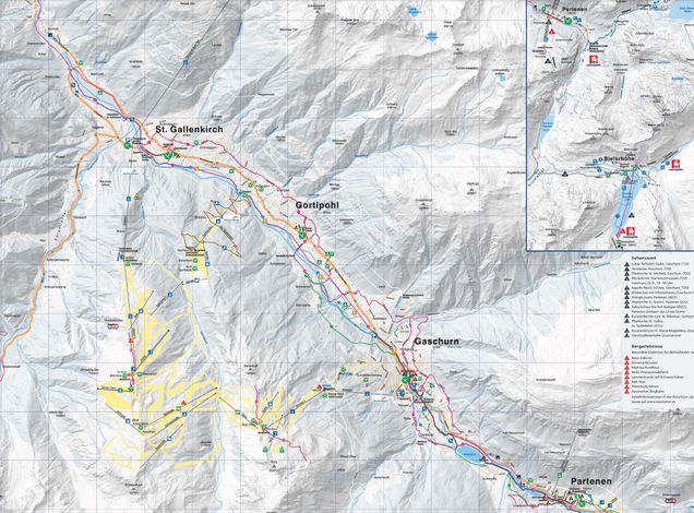
Cross-country map St. Gallenkirch
To enlarge please click onto the trail map

Accommodations in St. Gallenkirch

Map enlarge

Search…

: Cross-country St. Gallenkirch

Currently there are no offers available.

Book safe with SnowTrex advantages

StickyNewsletter